
I lived near a street named “Cherokee Trail” in Lexington, SC and wondered if there was a connection with the infamous “Trail of Tears.”
ChatGPT said:
I found something that makes your question particularly interesting. Cherokee Trail in Lexington, South Carolina, very likely takes its name from an actual historic Cherokee route—not the Trail of Tears.
According to the Town of Lexington’s official history, two major Native American trails crossed what is now Lexington County:
- The Cherokee Path, which roughly followed present-day US Highway 378.
- The Occaneechi Path, which roughly followed present-day US Highway 1.
Even more interesting, a local history of Lexington County specifically states: The Cherokee Trail parallels Hwy 378 west of Lexington between Hwy 378 and Lake Murray.
It describes the route as one Cherokee people used to travel from their upcountry villages toward Granby and the Lowcountry. Parts of this ancient route survive in roads including Old Cherokee Road, Leaphart Road, and Mineral Springs Road. See lexcohistory.blogspot.com
The trail existed long before the forced removals of the 1830s. By the early 1700s, it had become an important trading route connecting Cherokee settlements in northwestern South Carolina with Charleston.
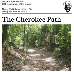
The National Park Service has even preserved a walkable portion of the original Cherokee Path at Ninety Six National Historic Site.
Do you remember approximately where along Cherokee Trail you lived—near US 378, Old Cherokee Road, or somewhere else?
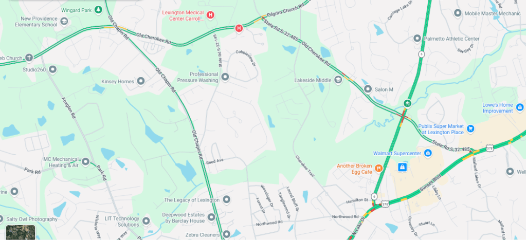
The street connected to Old Cherokee Road which intersected and at times ran parallel to US 378.
ChatGPT said:
That makes the connection considerably more compelling. The fact that Old Cherokee Road both intersects and parallels US 378 suggests that the street may preserve part of the old route—or at least its historical alignment.
I found a particularly relevant passage in a Lexington County history: The Cherokee Trail parallels Hwy 378 west of Lexington between Hwy 378 and Lake Murray. The author also identifies it as the route Cherokee people followed between their upcountry villages and the Lowcountry. See lexcohistory.blogspot.com
There’s also a documented historical milestone: in 1747, the South Carolina General Assembly authorized the Old Cherokee Path to become a public road. So you may have lived near a road whose history reaches back several centuries. I can’t establish that the modern pavement follows the precise original footpath, but the geographic connection is quite strong.
You can read the Lexington County history of roads and trails for more detail.
Where did the trail of tears start?
ChatGPT said:
The Trail of Tears began in several locations across the southeastern United States, primarily in Georgia, Tennessee, Alabama, and North Carolina. The best-known forced removal was that of the Cherokee Nation in 1838–1839, although other Native American nations were also forcibly relocated.
For the Cherokee, two particularly important starting areas were:
- New Echota, Georgia — The Cherokee national capital, near present-day Calhoun. It was also where the controversial Treaty of New Echota was signed in 1835.
- Ross’s Landing, Tennessee — Present-day Chattanooga. This was a major departure point for Cherokee people traveling west, particularly by water.
The Cherokee were rounded up by federal and state forces, held in stockades and camps, and then marched or transported roughly 800–1,000 miles west to what is now Oklahoma. Thousands died from disease, exposure, hunger, and exhaustion.
One important distinction: The Trail of Tears was not a single trail or a single event. The Choctaw, Muscogee (Creek), Chickasaw, and Seminole peoples also experienced forced removals, beginning before the Cherokee removal.
Since you’re in South Carolina, there’s an interesting local connection: the Cherokee historically occupied northwestern South Carolina, particularly the area around present-day Oconee County. Their removal history began well before the famous 1838 march.


Leave a Reply